If you are unable to use the map please contact us.
Use the panel on the left to locate the area of interest and display the relevant Traffic Regulations Orders (TROs).
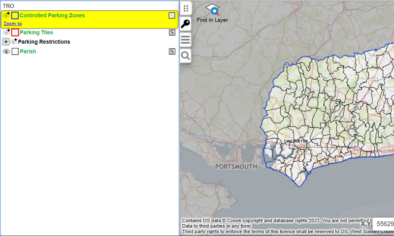
The panel on the left has four symbols, of which two are useful, the key icon and the magnifier icon. When used, they will then expand to show further symbols used for the map layers. The symbols are explained in the table below.
| Symbol | Description |
|---|---|
|
|
The Address search. This allows for searching by address or coordinates. |
|
|
The key. This lists the various layers shown on the map. |
|
|
A black eye means the layer is visible. |
|
|
An eye with no pupil means the layer is not displayed. Click the symbol to view. |
|
|
A greyed-out eye with a plus symbol means the layer is not currently visible. Zoom into the map to view. |
|
|
The plus symbol next to the eye means this layer can be expanded out to view its subcategories. |
|
|
A greyed-out 'S' indicates the layer is not selectable and results will not appear in the popup. |
|
|
A black 'S' indicates the layer is selectable and results will appear in the popup if the layer is also visible. |
Searching using the key
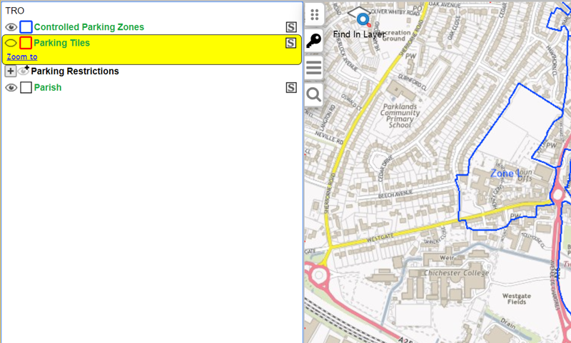
The 'Find in layer' tool allows you to look for a location by layer.
When selecting a layer, it will appear in yellow highlight indicating that it is active. The 'Find in layer' tool will then be visible in the map, allowing you to search the layer.
Searching using address search
Alternatively, click the magnifying glass (address search) symbol to search by address or by coordinates. Please be aware the coordinate search is by British National Grid coordinates and not latitude/longitude.
Viewing TROs
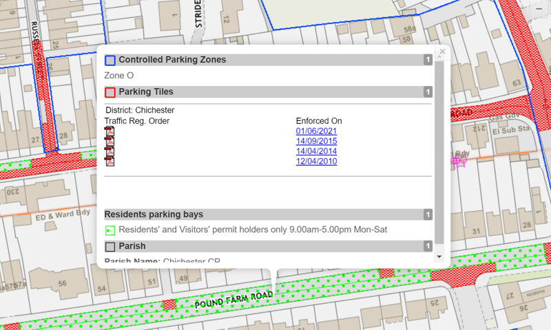
Parking details can be viewed when zoomed into street-level. Clicking on the map will open a popup for all layers that are set as both visible and selectable.
This will provide information for each layer at the point it is clicked.
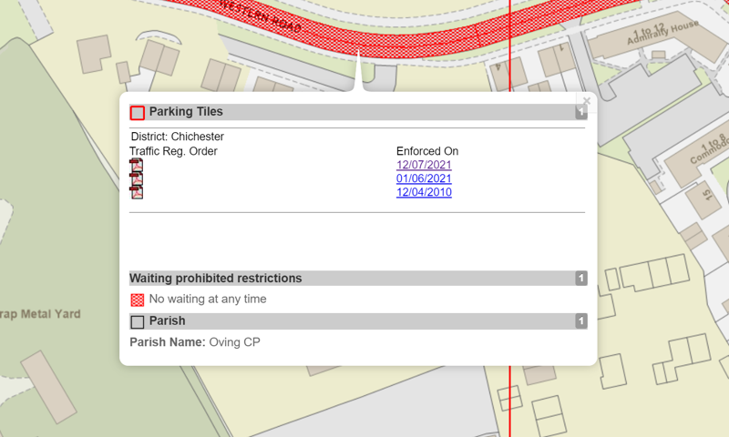
In the example above, details are revealed for all TROs made for this area under the 'Parking Tiles' heading, as links to the actual PDFs held for each order.
The latest dated TRO represents the current enforceable order. All other dates represent superseded orders.
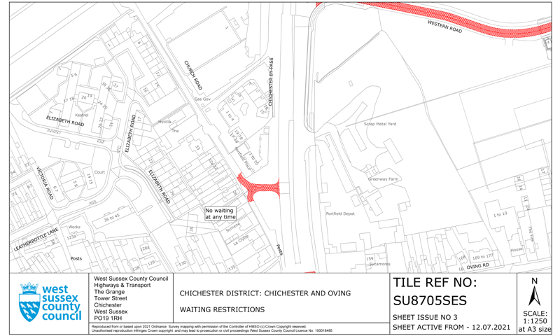
Click on the relevant PDF link to open the document showing parking and waiting restrictions for that area, such as the example below.
Also in this example is the parking restrictions and parish subcategory layers.
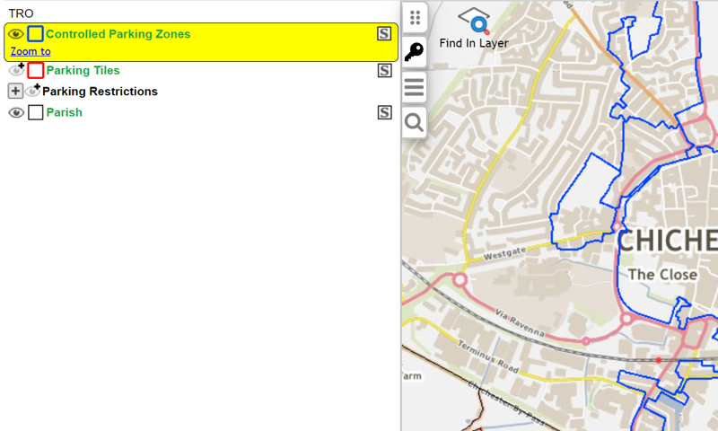
Controlled parking zones (CPZs)
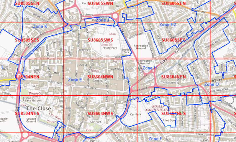
One further level of detail available on the map is CPZs. The boundaries for these are visible at all zoom levels.
To view the associated labels for each zone, zoom into the map.
If you wish to focus at this level purely on the CPZs, consider clicking the eye-icon for the 'Parking Tiles' layer. This will hide that layer in the map.
If the map is clicked inside a CPZ, the zone’s name will be displayed. Outside a CPZ zone, no information will be displayed.